
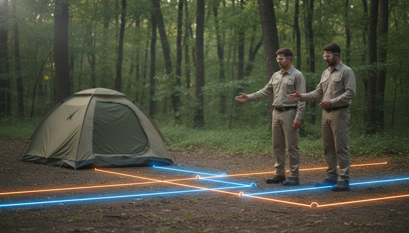
A single backhoe strike can flood a bathhouse, cut off Wi-Fi park-wide, and evaporate a month of profit in one muddy afternoon. What if your maintenance team could “X-ray” the ground with a tablet instead—seeing every pipe, power line and fiber run in living color before the first shovel turns?
That’s the promise of augmented-reality utility overlays, a fast-growing $1.4 billion niche now filtering into campgrounds and RV resorts. Point a phone, and subterranean infrastructure snaps into view with centimeter-level accuracy. Fewer emergencies. Faster permits. Staff trained in days, not seasons.
Ready to swap guesswork for ground truth—and turn the same digital map into a guest-pleasing tour? Keep reading; the next five minutes could save your park from its most expensive dig yet.
Key Takeaways
• One wrong shovel hit can flood buildings, cut Wi-Fi, and wipe out profits
• Augmented reality (AR) apps let staff “see” buried pipes and wires on a tablet or phone
• Accurate maps mean fewer emergencies, faster repairs, and lower insurance bills
• Building the map (digital twin) uses radar, LiDAR, and GPS to nail down locations within centimeters
• A single cloud map feeds permits, training, and expansion plans all in one place
• Tablets in the field glow with live data—staff know what’s below before digging
• Start with the riskiest spots, add more areas each off-season to spread costs
• Name a data steward to keep maps updated and prevent drift
• New workers learn the system in days; quick drills make safe digging a habit
• Guests can join cool AR tours, boosting STEM fun and extra revenue.
The Market Has Shifted Under Your Feet
Construction giants and municipal utilities have already embraced AR map overlays, and the spend is exploding. Analysts peg the AR-for-utility-mark-outs slice of the pie at $1.4 billion in 2024, with the broader underground-mapping market racing toward $3.3 billion by 2030.
Those numbers come straight from an AR market study and a complementary market forecast. While bulldozers and city planners drive much of that growth, the outdoor-hospitality niche is poised to benefit even more because a single strike can halt guest operations instantly. Insurers have noticed, and operators who document strike-prevention measures are already negotiating lower liability premiums and friendlier deductibles.
Building a Digital Twin of Your Park
Everything starts with a map accurate enough to trust in a downpour after dark. Modern ground-penetrating radar and LiDAR scans layer on top of legacy as-builts, then RTK-enabled GNSS receivers pin every point to within a few centimeters. Machine-learning algorithms clean up the noise, aligning old CAD drawings with the physical world.
Once surveyed, those lines move into a cloud GIS—your single source of truth. A named data steward, whether a tech-savvy staffer or a GIS partner, owns version control and archives every contractor update. Annual verification walks with a locator wand and tablet keep reality and records in sync, ensuring the digital twin ages like wine, not milk.
Field Wins: Tablets That See Through Soil
With the digital twin in place, field techs simply pull a rugged tablet from the truck, open an AR viewer, and watch buried assets glow in front of them. Apps let crews jump to known endpoints via QR codes, trace a water main in real time, and log new finds with one tap.
IoT sensors feed live data—flow, pressure, voltage—back into the GIS. Picture standing over a sewer lateral and seeing a green status light float above it. No more radio calls to the shop; the tablet confirms normal flow instantly. The result is fewer emergency digs and faster troubleshooting when “the Wi-Fi is down” turns out to be a nicked conduit.
Budgeting Smarter Than Your Backhoe
Sticker shock keeps many owners on the sidelines, yet phased rollouts shrink initial outlay. Start with the highest-risk zones—densely packed restrooms, shared hookups, food-service pads—then expand each off-season.
Because the same GIS layers support permitting, insurance documentation, and expansion planning, the cost spreads across multiple budget lines instead of one giant capital hit. Hardware is forgiving; most modern GNSS-ready tablets and phones run leading AR viewers, so there’s no need to gamble on proprietary headsets until the value is proven. Soft-cost savings—shorter 811 clearance times, faster staff training, and fewer Saturday-night water breaks—routinely cover the initial survey within a couple of seasons at mid-size parks.
Governing Data for Seasons, Not Seconds
A shiny new AR app is worthless if data drift sets in. Assigning a data steward isn’t bureaucratic bloat; it’s strike insurance. That person vets every contractor as-built, pushes updates to the cloud, and locks down naming conventions so “Main-Elec-South” always means the same feeder.
Redundancy matters when a storm knocks out connectivity. Keeping one encrypted backup onsite and another offsite guarantees you still have a map when the server room floods. Scheduled annual verification walks—think spring tune-ups for your GIS—catch small discrepancies before they require jackhammers.
Training and Change That Stick
Seasonal turnover is a fact of outdoor hospitality, but AR turns rookies into reliable locators in a week. Ten-minute micro-drills—“find the nearest shut-off” or “trace this feeder line”—combine muscle memory with visual feedback. Pair new hires with a tech-savvy mentor during the first locate, and confidence skyrockets.
Better yet, you don’t need to rewrite every standard operating procedure. Just add “open AR viewer” to the existing dig-permit checklist and mount a tablet kiosk by the tool cage. Landscapers, housekeepers hanging hammocks, even the security team driving fence posts start checking the overlay on instinct, slashing accidental strikes across departments.
Risk, Regulation, and Insurance Leverage
Every 811 or One-Call ticket requires documentation. AR makes it effortless: capture a time-stamped screenshot showing lines, depth cues, and GPS coordinates, then attach it to the ticket. Color-coded overlays match national standards—red for electric, blue for potable water—so digital and spray-painted marks speak the same language.
Insurance adjusters love proof. During renewal season, dropping a folder of AR locate logs on the desk reframes the discussion from claims history to preventive controls. One 120-site park that adopted AR last year saw emergency dig costs fall 60 percent and secured a five-figure reduction in liability premiums within one renewal cycle.
Guest-Facing Opportunities You Can Sell Tomorrow
Turning utility maps outward may sound risky until you see guests lining up for an evening “behind-the-scenes” cart tour. Families open the park app, toggle an opt-in “infrastructure” layer, and watch power, water, and fiber routes animate beneath the gravel. It’s a mini STEM lesson—and a premium ticketed experience.
Marketing gets a boost too. Campers snapping screenshots of glowing lines under their RV share them on social media, tagging your park as tech-forward and safety-minded. Highlighting buried fiber during the tour reinforces why those upgraded Wi-Fi sites command higher nightly rates.
A Five-Step Deployment Roadmap
Rolling out AR successfully is less about gadgets and more about process. By framing each phase as a discrete objective—survey, visualize, train, govern, and expand—you turn a daunting overhaul into a series of achievable wins. The roadmap below breaks that journey into five logical steps any maintenance team can follow.
1. Book a comprehensive locate and RTK survey; quality in equals quality out.
2. Choose an AR viewer that reads your GIS natively and supports external GNSS antennas.
3. Train field staff to capture updates—photos, coordinates, short notes—on the same devices they already carry.
4. Curate the data in the back office; the steward reviews edits weekly and pushes tested layers to production.
5. Pilot the system in one high-risk zone, measure strike incidents and staff feedback for a month, then iterate and expand. Each phase pays for the next.
Treat the list as a living playbook, not a one-off project. Schedule quarterly check-ins to review progress, tighten SOPs, and celebrate cost-avoidance wins with the team. Consistent iteration keeps momentum high and ensures you never slip back into the guess-and-dig habits that cause strikes.
Looking Ahead: Wearables, AI, and Beyond
Hardware costs keep falling; analysts forecast sub-$500 lightweight headsets by 2027. Voice-enabled AI copilots will soon let a solo tech say, “Trace gray-water line to lift station,” and watch a glowing path appear—a level of guidance hinted at in recent new products round-ups. The same spatial map could fuel guest treasure hunts or sustainability games, wringing more revenue from data you already own.
Looking even further out, cloud-based predictive models will cross-reference weather alerts, soil saturation, and load data to flag lines at high risk of failure before a leak or short ever occurs. Because your GIS is open and standards-compliant, these future tools will plug straight in, protecting today’s investment while unlocking tomorrow’s innovations.
Bring the invisible into view and you’ll uncover more than utilities—you’ll reveal new margins, happier guests, and a marketing story that practically writes itself. Insider Perks can stitch that digital twin straight into your website, automate the alerts that keep strikes at zero, and feed the same AR content into ad campaigns that set your park apart. Ready to turn underground insight into top-line growth? Connect with our team and let’s map out the next layer of your success.
Frequently Asked Questions
Q: How precise are the AR utility overlays in a campground setting?
A: When the underlying map is built with RTK GNSS and modern locating tools you can expect horizontal accuracy within two to four centimeters and depth estimates within five to ten, close enough for a shovel-level decision and well within 811 tolerance zones, even on wooded or sloped sites.
Q: What does the initial mapping survey typically cost for a mid-size RV park?
A: Most operators report $8,000 to $20,000 for a 100- to 150-site property, depending on terrain complexity and record quality; the range covers ground-penetrating radar, RTK control points, and data cleanup, and it is usually recouped after one avoided emergency dig or a modest insurance premium reduction.
Q: Do I need to buy expensive headsets to use AR in the field?
A: No—current viewers run on any late-model iPad, Android tablet, or smartphone paired with a Bluetooth GNSS puck, so you can start with devices you already issue to maintenance or housekeeping crews and add purpose-built wearables only if they prove valuable later.
Q: Can my seasonal staff learn this without a GIS background?
A: Yes; most parks roll out a one-hour classroom demo followed by three or four 10-minute “find the shut-off” drills, and new hires are locating confidently in less than a week because the overlay provides immediate visual feedback.
Q: How do I keep the data from drifting out of date after contractors make changes?
A: Assign a data steward in your SOP who reviews every as-built, approves edits pushed from field tablets, and schedules an annual verification walk; the workflow takes a couple of hours a month and prevents the slow creep of mismatched drawings that cause strikes years later.
Q: What happens if Wi-Fi or cellular service is down when a crew needs the map?
A: Most AR apps cache the latest project locally and sync when a connection returns, so the tablet still renders utility lines in real time even during an outage as long as the GNSS receiver has satellite lock.
Q: Is the information secure from guests or curious employees?
A: Data lives in a permission-based cloud GIS; field tablets require authenticated log-ins, and guest-facing layers can be stripped of sensitive depth or line-type details so you control exactly who sees what.
Q: Will my insurance carrier really give me a break for using this technology?
A: Underwriters increasingly treat documented strike-prevention programs as a risk modifier, and parks that supply AR locate logs at renewal report 5–15 percent liability premium reductions and lower deductibles because they demonstrate proactive loss control.
Q: How does this integrate with 811 or One-Call tickets?
A: Your crew still files the ticket, but the AR overlay lets you pre-mark internally, capture a time-stamped screenshot for your records, and give contract locators a clearer starting point, often shortening clearance times and reducing mismarked paint on your gravel pads.
Q: Can I phase the rollout to fit next year’s budget?
A: Absolutely; many owners start by mapping the highest-risk cluster—bathhouses, main electrical feeders, Wi-Fi trunks—then expand each off-season, spreading the cost across multiple capital lines while staff gains familiarity.
Q: What is the typical ROI timeline for a campground?
A: Parks averaging one or two minor strikes a year usually cover the full implementation within 18–24 months through avoided repairs, reduced downtime, faster permitting, and insurance savings, with larger resorts seeing payback even faster.
Q: Could guest access to the overlay create liability if they poke around and get hurt?
A: Sharing a sanitized, read-only layer for educational tours keeps critical depths and shut-off locations hidden, and your terms of use can disclaim reliance; the public-facing map is purely illustrative, just like an interpretive trail sign.
Q: Can drones or LiDAR help build the digital twin faster?
A: Yes; aerial LiDAR captures surface grades and structural features in hours, providing an ideal backbone for the underground data collected by ground crews, and the combined dataset improves stormwater planning and future site expansion designs as a bonus.
Q: How deep can the system see, and does soil type matter?
A: The AR overlay itself is only as deep as the data you feed it, but modern GPR locates metallic and non-metallic lines to roughly 12 feet in most soils; heavily saturated clay or high-mineral content can reduce range, which is why a mixed toolkit—records, locators, radar—is still best practice.
Q: What maintenance costs should I budget after year one?
A: Plan on an annual verification walk, occasional contractor updates, and a modest cloud-hosting fee—typically a few hundred dollars per year for most parks—plus device replacement on a normal three-year cycle, all of which is minor compared to the first survey.