
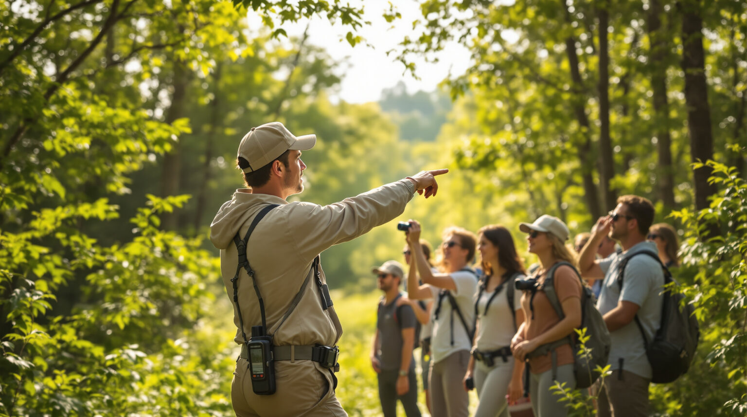
Picture this: a camper’s phone buzzes just as the sun slips behind the pines—“Bull elk grazing 200 yards north of Loop C.” Ten minutes later, your meadow is lined with wide-eyed families, cameras clicking, and social feeds tagging your park in real time. That single push notification didn’t just thrill your guests; it triggered a memory they’ll book again (and tell everyone about).
If that sounds futuristic, consider what’s already here: Parkwolf’s latest app lets visitors preload offline heat maps, Hipcamp just doubled its listings to 565,000 nature-hungry travelers, and drone-powered trackers can now spot wildlife at 17 fps. Translation? Personalized, GPS-driven wildlife guides are no longer a novelty—they’re the next must-have amenity.
Ready to turn “We have Wi-Fi” into “We have a live wildlife channel”? Read on to see how a few strategic upgrades can transform sightings into five-star reviews, new revenue streams, and a competitive edge that algorithms—and animals—can’t ignore.
Key Takeaways
The list below condenses the playbook into bite-sized actions you can start this weekend, from field-mapping elk hotspots to monetizing sunrise tours. Think of it as a cheat sheet for leveling up guest experiences while future-proofing your revenue against the ever-growing competition on booking platforms and Google searches.
Skim the bullets, share them with your team, and then dive into the detailed sections that follow; each point is expanded later with tech tips, workflow templates, and real-world examples so you can implement without guesswork.
– Guests love fast animal alerts; it makes them book again and tell friends.
– Hipcamp and new apps show people now expect real-time nature info.
– Strong Wi-Fi spots, solar chargers, and easy QR downloads keep phones working even offline.
– Walk the trails with GPS and mark where animals like to eat, drink, and rest; set geofences to send alerts.
– Assign staff to check each sighting and use color codes for safe, caution, or danger animals.
– Teach guests to stay back and be quiet; pop-up pledges and signs help protect wildlife.
– Offer sunrise tours, collectible pins, and photo sales to earn extra money.
– Follow drone laws, add no-fly zones, and be ready to stop alerts for emergencies.
– Watch numbers like app downloads, repeat stays, and upsell sales to see if the plan works.
Market Signals: Guests Now Expect Real-Time Nature Intel
Hipcamp’s meteoric rise to 565,000 listings in 2025 means guests are shopping dozens of comparable parks within seconds on Hipcamp. In a sea of availability calendars and similar nightly rates, properties offering interactive wildlife tools earn the instant swipe right. Reviews consistently show “wildlife encounters” as a top memory trigger, and that emotional hook translates into longer stays and more word-of-mouth referrals.
Meanwhile, Parkwolf 4.1.4 widened coverage from national treasures to state-park and private-land data, proving that real-time animal alerts work even where cell bars do not Parkwolf offline maps. When guests know they’ll receive a buzz the moment a moose wanders near the creek, they worry less about signal dead zones and more about charging camera batteries. The expectation of instant, accurate wildlife intel is now baked into booking decisions, making slow or absent alerts feel like dial-up in a broadband world.
Tech Toolkit: Building a Reliable Wildlife Channel
Start by strengthening digital infrastructure at your hotspots. Mesh Wi-Fi nodes or “boost zones” near trailheads keep phones synched without draining guest data plans, while small solar charging stations ensure visitors aren’t forced back to their RV just to top off batteries. A simple QR code at check-in that auto-downloads your offline map layer means even airplane-mode hikers stay looped in.
Quarterly audits of trail coordinates and signage prevent the dreaded “the app says 0.2 miles, but we’re still walking” complaint. Cross-check your GPS waypoints, refresh them in the guide, and you’ll maintain the trust that powers five-star ratings. These upgrades may sound technical, yet most can be handled by a local IT contractor for less than a weekend’s vacancy loss—an ROI that compounds each review cycle.
Mapping and Tagging Habitat Hotspots
Great alerts begin with accurate data. Walk your property with a handheld GPS recorder, logging every track, overlook, and watering hole. Pair that fieldwork with input from local wildlife biologists; their insight on seasonal movements turns static maps into dynamic encounter grids.
Mark dawn feeding zones, midday shade pockets, and twilight crossings so your alerts feel almost psychic to guests. Once waypoints are locked, upload them into your mobile guide and layer geofences that trigger push notifications. Include trail difficulty, average walking times, and battery-saving tips in each pin description so guests understand exactly what they’re hiking into before they lace up.
Staff Workflows That Keep Sightings Trustworthy
Nothing kills excitement like a false alarm, so assign a “wildlife concierge” each shift to vet incoming guest sightings before they hit the live feed. A quick photo check and species confirmation filters out prank posts while reinforcing your brand’s commitment to accuracy. Seasonal workshops with local naturalists boost staff confidence, arming them with talking points that elevate casual conversations into mini-interpretive sessions.
A color-coded escalation chart—green for deer, amber for nuisance raccoons, red for a prowling cougar—helps front-desk teams decide when to push alerts, when to call maintenance, and when to trigger emergency protocols. Maintenance staff can also consult the hotspot dashboard to time mowing or trash runs during low-activity windows, reducing wildlife conflicts before they start. End-of-day debriefs or quick Slack updates log notable encounters, ensuring every team member stays synchronized and lessons carry over to the next shift.
Delighting Guests While Protecting Wildlife
Education is a soft barrier that saves you from hard liabilities. Embed a pop-up pledge: “If you can’t hide the animal behind your thumb at arm’s length, you’re too close.” Require an “I agree” tap before the sighting feed unlocks. On-property, laminated speed-limit cards on bikes and golf carts remind guests to slow down during dawn and dusk, when fawns and fledglings are most vulnerable.
Geofenced quiet zones silence alert pings near nesting areas, preserving both wildlife and the sense of wilderness your guests crave. An evening campfire talk on Leave No Trace principles fosters a community that self-polices; guests who understand the why will gently correct those who don’t, lifting the burden from your staff. The sudden hush also heightens the experience, letting visitors catch the whisper of an owl’s wingbeat or the distant splash of a beaver tail.
From Wow Moments to New Revenue Streams
Turn data into dollars with a premium “sunrise safari” priced just above average nightly rates. Using live hotspots, guides lead guests directly to the morning’s most active zones, then upsell branded enamel pins awarded for verified sightings. Limited-edition merchandise sparks a collectible mindset, drawing past visitors back to complete their set.
Partnerships amplify reach. Donate a dollar from each premium app download to a regional wildlife charity, framing the fee as a conservation contribution rather than an upcharge. Local photographers can license high-resolution prints through an in-app storefront, earning commission while giving guests a tangible memory—and your park a passive revenue stream. Co-branded social campaigns then broadcast those stories across both audiences, multiplying impressions at nearly zero cost.
Compliance and Risk You Can’t Ignore
Thinking about drones? The WildLive study proved multi-animal tracking at 17 fps using Jetson Orin hardware as documented in this research, but tech dazzles only if it’s legal. Keep flights below 400 feet, maintain line of sight, and log each outing to stay FAA-compliant. Add “no-fly” polygons over protected habitats to avoid accidental harassment fines.
Prepare for surprises by programming an emergency override that pauses all sighting alerts and instead pushes evacuation routes if a bear wanders into camp. Revise your liability waiver to mention mobile alerts and aerial observation in plain language; guests respect transparency, and clear documentation shields you when incidents arise. Recording every incident in a digital logbook also gives insurers and regulators the clear paper trail they expect.
Measuring Success and Iterating Fast
Numbers tell the board—and Google—how well you’re performing. Track app downloads against total check-ins, sighting-feed engagement, and average time on trail. Look for a lift in repeat bookings and social-media mentions that tag your property; both signal that alerts are translating into share-worthy moments.
On the revenue side, monitor conversion rates for paid walks, merchandise sales, and premium app tiers. Aim for 15–20 percent of guests opting into at least one upsell in the first season. Adjust pricing, tour capacity, and alert cadence based on these metrics, and you’ll evolve the program the way wildlife adapts to a healthy habitat—resilient, scalable, and always in motion.
The next time a guest’s phone pings with “owl on the ridge,” it should also whisper your brand story—and that’s where Insider Perks steps in. Our marketing, AI, and automation pros can stitch those GPS hotspots into custom apps, drip social content the second a sighting goes live, and trigger follow-up campaigns that convert wowed campers into lifelong ambassadors. If turning wildlife data into five-star demand sounds like the edge your park needs, let’s chart the trail together. Schedule a quick strategy session with Insider Perks and see how easily your first elk alert can become your next fully booked season.
Frequently Asked Questions
Before you dive into gear lists and budget lines, the FAQs below tackle the most common concerns operators raise—from costs and coverage to privacy and accessibility. Read through for peace of mind, then share with stakeholders so everyone starts on the same knowledge footing.
Q: What does it actually cost to launch a GPS-based wildlife guide at my park?
A: Most properties spend between $3,000 and $7,500 for the first season, which covers a handful of mesh Wi-Fi nodes, a mid-range tablet or two for staff, a one-time map build by a GIS contractor, and a white-labeled version of an existing wildlife-alert app; after that, annual fees usually drop to a few hundred dollars for app licensing and data hosting, well below the revenue gained from even a few added bookings per month.
Q: Do I need full cell coverage on every trail for this to work?
A: No, the better platforms let guests preload offline map layers at check-in, then use GPS—which functions without cell service—to trigger geofenced alerts; a couple of boosted Wi-Fi spots near trailheads are enough to sync sightings when hikers return to signal.
Q: How do I keep sightings accurate and avoid prank or mistaken reports?
A: Assign one on-shift employee as a wildlife concierge who quickly validates any guest post with a photo check or staff confirmation before pushing it live; because that step happens inside the manager dashboard, false alarms are filtered out in under a minute and your credibility stays intact.
Q: What happens if a dangerous animal, like a bear, wanders into camp?
A: The same geofence system can flip into safety mode, pausing normal alerts and pushing a prewritten emergency notification that tells guests to shelter or move to designated safe zones while simultaneously pinging staff radios so everyone follows the same protocol.
Q: Won’t promoting wildlife viewing increase my liability exposure?
A: Your exposure is reduced, not raised, when you combine an updated waiver that discloses mobile alerts with mandatory in-app safety pledges, staff verification of sightings, and distance guidelines that mirror state wildlife-agency recommendations, all of which demonstrate proactive risk management if an incident ever reaches legal scrutiny.
Q: What about guests who don’t want to download another app?
A: A scannable QR code can open a lightweight web page that mirrors the live feed and offline map without a formal install, so tech-shy visitors can still receive browser-based push alerts and you don’t lose engagement or upsell opportunities.
Q: Can I integrate wildlife alerts into the reservation or loyalty app I already use?
A: Yes, most major campground software vendors expose an API or webhook that lets the wildlife platform push real-time alerts, heat maps, and upsell offers into your existing guest app or even into SMS messages tied to the reservation record.
Q: How do I protect guest data and location privacy when phones are constantly pinging GPS?
A: Leading apps process location data locally on the device and only transmit an anonymous sighting confirmation, so you never store identifiable movement tracks on your servers, keeping you squarely inside GDPR, CCPA, and most state privacy statutes.
Q: Will constant phone buzzes ruin the sense of peace my park is known for?
A: The alert cadence is fully customizable; most operators cap standard wildlife pings at two per hour and mute notifications inside predefined quiet zones, so guests hear about the bull elk without feeling like they’re in a theme park.
Q: How can I turn the guide into real revenue instead of just a free perk?
A: Properties typically offer a paid sunrise or dusk tour that uses live hotspot data, sell collectible pins for verified sightings, and gate premium features—like archival heat maps or pro photography tips—behind a $4.99 in-app upgrade, converting about one in five users without harming overall satisfaction scores.
Q: What equipment do my staff need to maintain the system day-to-day?
A: A rugged tablet or smartphone with admin rights, a shared spreadsheet or dashboard to log new waypoints, and a portable power bank for fieldwork are sufficient; no special servers or high-end cameras are required unless you opt into drone tracking later.
Q: How often should I audit and refresh my habitat waypoints?
A: A quick seasonal walk-through—spring fawning, mid-summer grazing, fall rut, and winter denning—keeps your map current and takes less time than mowing a large field, yet it preserves the accuracy that drives five-star reviews.
Q: Are drones a must, and are there legal hurdles if I use them?
A: Drones are strictly optional; most operators get excellent results from ground-based sightings alone, but if you do add aerial tracking you’ll need an FAA Part 107-certified pilot, 400-foot ceiling, daytime line-of-sight flights, and no-fly polygons over sensitive habitat, all of which a local drone contractor can handle under a standard service agreement.
Q: How do I make the experience accessible to guests with disabilities?
A: Choose a platform that’s WCAG-compliant so screen readers can vocalize alerts, add vibration cues for the hearing-impaired, and include mileage and grade descriptions for each geofenced trail segment, ensuring that every guest—regardless of ability—can safely participate in wildlife viewing.
Q: What kind of ROI should I expect in the first year?
A: Parks that promote the feature in their booking funnel typically see a 5–8 percent lift in mid-week occupancy, a 12 percent bump in social mentions tagged to the property, and direct incremental revenue from tours and merch that pays back initial costs before the peak season ends.