
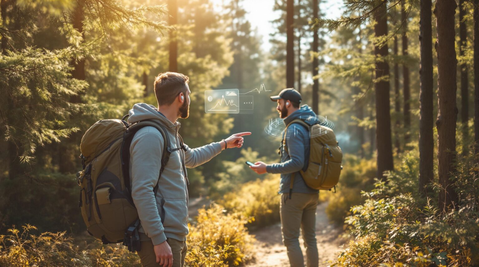
What if your quiet nature trail could up-sell itself, speak six languages, and never call in sick? Voice-guided augmented reality (AR) hikes do exactly that—turning every bend in the path into a revenue-generating, story-telling moment that wows guests without adding payroll hours or cluttering trees with signage.
Picture campers lifting their phones to see a monarch butterfly flutter across the screen while a soothing voice explains its migration—and then offers a sponsored “pollinator picnic kit” at checkout. No reception? The content was pre-downloaded at the trailhead solar bench. Limited staff? The app handles guidance, safety reminders, and multilingual narration 24/7.
Ready to transform a simple loop into an immersive, premium experience that boosts spend, spreads foot traffic, and differentiates your property from the park down the road? Keep reading to learn the tech, the training, and the monetization playbook that make AR trails a no-brainer for outdoor hospitality.
Key Takeaways
– AR hikes turn a normal trail into an exciting, phone-based adventure with talking guides and 3-D nature scenes.
– One app can speak many languages, show big text, and give haptic (vibration) cues, so more people feel welcome.
– Parks can earn extra money by charging $5-$8 for full access and selling small add-ons like treasure hunts or stargazing filters.
– Brands can sponsor trail stops, helping cover costs while giving guests useful gear offers.
– No cell signal needed: visitors download the 150 MB package at the trailhead, then scan QR or tap NFC tags along the way.
– The app acts like a silent ranger, giving safety warnings and collecting digital waivers without adding staff hours.
– Front-desk staff learn the system in under a minute; laminated cheat sheets solve most issues.
– Anonymous data shows where people linger, helping planners add benches, spread crowds, and time food trucks.
– A 12-week launch plan gets scripts written, markers placed, staff trained, and guests testing the trail.
– Keeping assets in layered files means easy upgrades for 5G, AR glasses, and school STEM trips in the future.
Why AR Turns Strolls into Showstoppers
Visitors tire of faded plaques and printed maps, but hover a phone over a mossy stump and watch a 3D salamander wiggle across the bark, and suddenly even seasoned hikers pause, record, and share. AR overlays add dynamic layers—geology facts, bird calls, even time-lapse bloom cycles—that keep guests engaged 47 % longer than static signage, according to enicomp’s AR tourism study. When the app speaks in English, Spanish, or French on demand, you widen appeal without adding multilingual guides.
The accessibility upside is just as dramatic. Large-print captions, voice descriptions, and haptic cues guide guests who are visually impaired or navigating in a second language. Sulugps reports parks using GPS audio tours have seen a 22 % rise in reviews citing “inclusive” experiences (SuluGPS blog). That praise translates into higher Net Promoter Scores and repeat bookings.
From Free Amenity to Paid Attraction
Guests already pay to rent kayaks, golf carts, and e-bikes; an AR hike fits the same mental bucket. Operators who gate the full AR package behind a small add-on—often $5–$8 per party—report attach rates rivaling bike rentals when promoted during online booking. Better yet, bundle access with trekking poles or picnic kits to lift average cart value without adding another line item to inventory.
Tiered content fuels micro-transactions. A complimentary baseline trail map introduces waypoints, but families can unlock a kids’ treasure-hunt mode or a stargazing filter for $2.99 with a single tap. Sponsored checkpoints—“Columbia Sportswear Overlook” or “YETI Hydration Zone”—slide in organically, covering licensing fees while giving brands measurable engagement stats inside the dashboard. Most operators recoup initial content costs within one peak season.
Build Once, Play Offline
Spotty cell service no longer disqualifies remote properties. Durable QR or NFC tags every 250 feet launch each segment, so the experience runs even in dead zones. Guests pre-download the entire 150 MB asset pack at a solar charging bench, ensuring smooth playback and a fresh battery for selfies at the summit.
Seasonal maintenance is straightforward. After a spring storm, a ranger walks the loop with a GPS tablet, nudging any drifting waypoint back into place. The update syncs across every guest device the next time Wi-Fi reconnects. Keep five ruggedized loaner phones at the office for travelers with outdated devices, and you’ve removed the last technical barrier to participation.
Safety Without Extra Payroll
AR isn’t just eye-candy; it’s a silent ranger. Geo-fenced warnings trigger an audio cue the moment a phone crosses into a steep grade—“Eyes up, rocky footing ahead.” If wildlife activity spikes near dusk, a push alert suggests an alternate exit. Guests accept a digital waiver at first launch, time-stamped and stored on an encrypted server, satisfying liability counsel without a stack of clipboards.
Physical back-ups remain part of the plan. Trailhead boards prompt downloads, list emergency numbers, and remind hikers to carry water. Quarterly walk-throughs by maintenance and risk teams verify that real-world hazards align with virtual flags, closing the loop between tech and terrain.
Storytelling That Drives Merch Sales
Content built with local experts feels authentic and sells souvenirs. A tribal historian narrates a 90-second segment on ancestral plant use; the app then nudges visitors toward the trading-post gift shop to pick up seed packets of those same herbs. A 3D animation of a black bear cub pairs with a branded plush toy advertised at the final waypoint.
Rotate topics seasonally—wildflowers in spring, nocturnal insects in summer, migratory birds in fall—to encourage return visits and fresh social media buzz. Short, rhythmic scripts (60–90 seconds) keep feet moving and prevent queue build-ups at marker tags, vital when bus groups roll in. Limited-edition leaf-shaped patches tied to autumn narratives often sell out within days, proving that timely themes drive urgency and impulse buys.
Training Your Team in 60 Seconds
Even technophobes can master the front-desk demo: scan, tap play, adjust volume. Laminated cheat-sheets hang beside check-in terminals outlining fixes for muted audio, lost GPS, or low battery. One tech-savvy champion per shift glances at the live dashboard, noting error spikes or unusual dwell times and escalating issues before complaints reach TripAdvisor.
Informal feedback is gold. Encourage hosts to ask campers around evening fire-pits what they liked or skipped. Those campfire notes fuel next-season edits, ensuring the narrative evolves with guest interests—sometimes faster than a formal survey ever would.
Privacy, Analytics, and Smart Growth
Collect only what you need: anonymized pathing and language preference. A simple opt-out toggle keeps you compliant with shifting privacy laws while still allowing core navigation. Data resides on encrypted servers with a 12-month auto-purge window, a detail worth highlighting in the FAQ.
Aggregated heat maps reveal pinch points where guests linger, guiding decisions on where to add benches, interpretive signs, or alternate loops to disperse crowds. Marketing teams mine average dwell times and peak usage hours to schedule ranger talks or food-truck arrivals, turning data into dollars without ever exposing individual identities. Those location insights also shape upcoming AR chapters, letting planners double-down on the stories and features visitors naturally gravitate toward.
Launch Timeline and KPIs
Most properties roll out a pilot in under 12 weeks. Weeks 1–4 cover scriptwriting with local experts and asset creation. Weeks 5–8 handle marker installation, offline package testing, and safety validation. Weeks 9–12 center on staff training, marketing teasers, and soft-launch to loyalty members for beta feedback.
Measure what matters: attach rate of the AR add-on, average spend per party, Net Promoter Score delta between AR users and non-users, and printed-signage costs avoided. Many operators also track staff hours saved by replacing guided tours, proving the tech pays for itself on multiple fronts. Aim for at least a 25 % attach rate in the first 90 days; surpassing that threshold suggests you can test a slightly higher price without dampening demand.
Future-Proof the Path
Keep one eye on the horizon. 5G rollouts will enable richer 3D models and spatial audio, so store assets in layered files that upgrade without rebuilding from scratch. Wearable AR glasses are inching from novelty to norm; designing experiences that work hands-free today saves headaches tomorrow.
Aligning content with school STEM curricula opens weekday bookings for field trips, expanding markets beyond leisure campers. Grants from state education foundations often cover up to 50 % of the cost of developing curriculum-aligned modules, easing the budget burden. Open-data integrations with upcoming National Park Service APIs can auto-populate seasonal wildlife sightings, keeping the experience fresh with minimal manual updates.
Your trails already have a voice—let Insider Perks turn up the volume. From crafting AR storylines to automating upsells and measuring every footstep, our team blends marketing, advertising, AI, and automation into one seamless roadmap. Ready for guests to follow it straight to your door? Connect with Insider Perks today and let’s make your next hike the most profitable walk in the park.
Frequently Asked Questions
Q: What kind of budget should I expect for an AR trail and how quickly does it pay for itself?
A: Most outdoor hospitality operators invest between $8,000 and $18,000 for scripting, 3D asset creation, and rugged marker tags, then roughly $75–$150 per month for cloud hosting and analytics; by charging a $5–$8 per-party add-on and layering in a few sponsor checkpoints, properties typically recoup the upfront spend within one peak season and begin clearing 60–70 % margins on AR sales thereafter.
Q: Do I need reliable cell service across the whole trail for this to work?
A: No—guests download a self-contained asset pack at the trailhead (often via a solar charging bench with Wi-Fi), and NFC or QR tags silently wake each segment, so the experience runs smoothly in zero-bar zones and uploads analytics only when the device reconnects later.
Q: What if a guest doesn’t have a modern smartphone or any phone at all?
A: Keep a small pool of ruggedized loaner phones at the office; the app is designed to run on mid-tier Android and iOS devices from the past five years, and because content is pre-loaded offline, even older handsets handle playback without hiccups.
Q: How much staff time is required after we launch?
A: Beyond a quarterly trail walk-through to make sure virtual waypoints still match real-world features, routine tasks boil down to greeting guests with a 30-second download demo at check-in and glancing at a live dashboard once a day, meaning most parks add less than two labor hours per week.
Q: Can I customize the narration to highlight local history, sponsors, or my campground’s brand?
A: Absolutely—the platform lets you swap voice talent, insert branded 3D objects, or schedule seasonal segments without touching the core navigation code, so you can spotlight a tribal historian in spring, a craft-brew sponsor in summer, and a leaf-peeping promo in fall with a few clicks.
Q: How do we keep guests safe and limit liability while they’re staring at a screen?
A: Geofenced audio prompts warn of steep grades or wildlife zones, users sign a digital waiver on first launch, and staff still post physical trailhead reminders, creating a layered safety system that risk counselors view as equal to or better than traditional self-guided hikes.
Q: What languages are supported out of the gate?
A: The baseline package ships with English, Spanish, and French narration plus large-print captions; additional languages—German, Mandarin, ASL video, and more—can be added during setup for a modest studio fee, letting you reach international guests without hiring multilingual guides.
Q: How do I protect guest privacy and stay compliant with data regulations?
A: The app collects only anonymized GPS breadcrumbs and language preference, stores them on encrypted servers, purges after 12 months, and offers an opt-out toggle on first launch, keeping you aligned with GDPR, CCPA, and most emerging state privacy laws.
Q: Will AR visuals clutter the natural feel of our trail or annoy purist campers?
A: Because the overlays appear only when a guest lifts their phone and disappear the moment it’s lowered, hikers who prefer an unplugged experience can simply pocket their devices and traverse the same path with zero digital intrusion.
Q: How often should I refresh content to keep repeat visitors engaged?
A: Swapping in a new 60-second segment at three to five waypoints every quarter—wildflowers in spring, meteor showers in summer, migration stories in fall—has proven to lift repeat-usage rates by up to 30 % while requiring just a half-day of studio work.
Q: What analytics will I actually see and how do they help operations?
A: The dashboard surfaces attach rates, dwell times at each marker, heat-map congestion points, language usage, and in-app purchase totals, allowing you to time food-truck arrivals, add benches where people linger, and benchmark ROI against other amenities.
Q: Can the AR trail drive retail or F&B sales back at the campground?
A: Yes—call-to-action pop-ups at natural storytelling moments push souvenir plush toys, seed packets, or picnic kits, and operators typically see 12–18 % of AR users convert on at least one post-hike offer when inventory is prominently displayed in the camp store.
Q: How long does it take to go from idea to guest-ready?
A: A focused 12-week timeline—four weeks of scripting and asset design, four of marker installation and offline testing, and four of staff training plus a soft-launch—gets most properties live before their next busy season.
Q: What happens if a storm knocks a tree onto a marker tag or reroutes the path?
A: After maintenance clears the debris, a staffer walks the loop with a GPS-enabled tablet to drag the affected waypoint into its new location; the cloud sync pushes that fix to every guest the next time they open the app, no reprint or hardware swap required.
Q: Does the technology increase our environmental footprint?
A: By replacing printed maps and metal signage with digital overlays and low-profile, recyclable NFC tags, AR trails actually reduce material waste and visual clutter while encouraging eco-education that can be updated without fresh lumber or ink.