
136 lives. One summer night. One hard question every campground owner must now ask: If a flash flood hit at 2 a.m., would my guests make it out?
The July 2025 Hill Country disaster exposed a brutal truth—many parks still sit squarely in floodways mapped years ago and forgotten. Texas responded with HB 19; other states are drafting copy-and-paste versions right now. Compliance isn’t optional, and reputations are erased faster than a river jumps its banks.
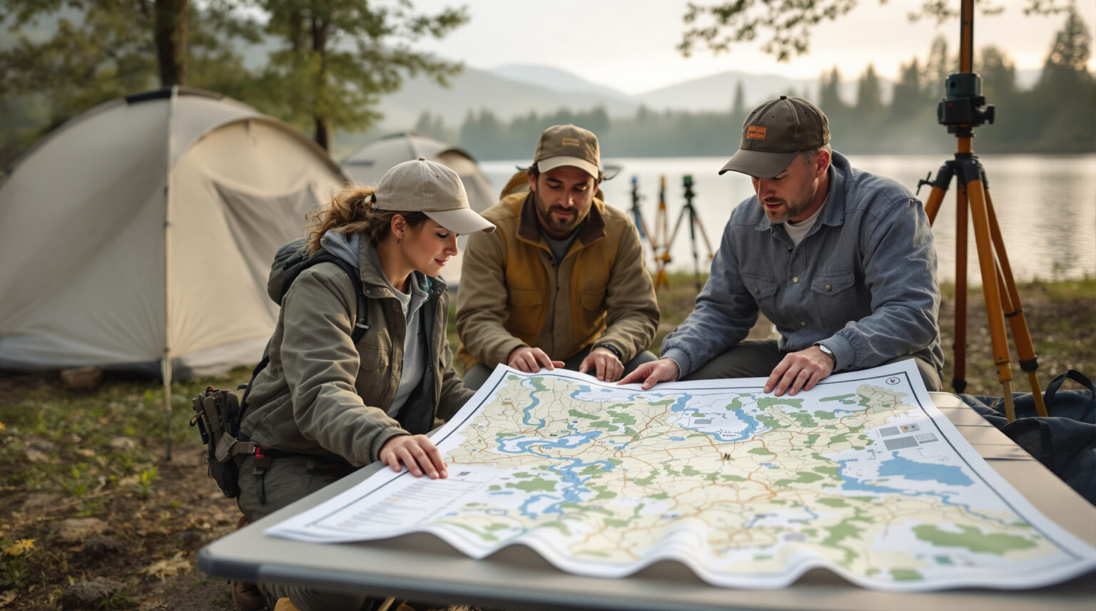
Read on to see how geospatial risk analysis turns lines on a map into life-saving decisions—where to site pads, raise utilities, carve out evacuation routes, and even cut your insurance bill. The data is already out there; the only real risk is ignoring it.
Key Takeaways
• Flash floods move fast and can hit while people sleep; every campground needs an escape plan.
• New rules, starting with Texas HB 19, make flood-safety plans the law for parks.
• Free tools—FEMA maps, county LiDAR, and simple computer models—show exactly where water will go.
• Raising or moving pads, wires, and propane tanks keeps gear and guests above flood levels.
• Swales, trees, and porous paths slow water and protect the land.
• Loud alarms, clear signs, and color-coded maps guide campers to high ground in minutes.
• Staff must practice drills so they act, not freeze, when sirens sound.
• Good flood planning cuts insurance bills, wins permits faster, and saves lives..
The Flash-Flood Wake-Up Call
Kerr County’s predawn torrent killed 136 people, destroying 37 RV sites at HTR TX Hill Country and leveling neighboring Camp Mystic and Blue Oak RV Park. Post-event findings confirmed that many pads lay inside officially designated floodways, some operating on grandfathered permits that never required modern mitigation. The grim arithmetic—44 campground guests gone—made national headlines and sparked investor panic as images of overturned travel trailers looped on cable news.
Lawmakers reacted in weeks, not years. Texas HB 19 now mandates a state-approved flood-disaster plan for every public or private campground and backs it with civil penalties for operators who fail to comply, according to the Houston Chronicle report. Similar bills are brewing in Florida, North Carolina, and Colorado. Waiting for the ink to dry is no strategy; regulators, lenders, and guests are already demanding proof of due diligence.
Geospatial Data: From Static Maps to Live Decisions
Modern flood resilience starts with a layered data stack. FEMA Flood Insurance Rate Maps expose macro-level risk—essential but too coarse when a pad sits inches below its neighbor. High-resolution LiDAR tiles refine that view to sub-meter precision, spotlighting micro-basins where water will pool first.
Hydrologic models like HEC-RAS then run “what-if” scenarios on rainfall intensity, letting owners visualize water depth in five-minute increments. Collecting these layers is no longer a Ph.D. exercise. The FEMA National Flood Hazard Layer viewer is free; county GIS portals often provide LiDAR downloads; and open-source QGIS stitches them together on a laptop.
Bigger portfolios can commission licensed floodplain engineers to produce interactive web dashboards that rank every site by inundation depth. Knowing which ten pads go under at seven inches of rain guides everything from relocation priorities to dynamic pricing. Geospatial clarity turns a static paper map into a living operational tool.
Designing Around Water, Not Against It
Once risks are mapped, smart design lowers them. Permanent buildings, electrical panels, and propane tanks belong at Base Flood Elevation plus two feet of freeboard, a small incremental cost that shields six-figure assets. Glamping tents can share raised decks, cutting disturbed soil and preserving root structures that slow runoff.
When relocation isn’t feasible, low pads become day-parking or pickleball courts that can tolerate a temporary splash. Hard infrastructure still matters, but nature lends muscle. Bioswales flank roads, capturing sheet flow and filtering silt before it chokes culverts.
A 100-foot riparian buffer of native willows stabilizes streambanks and reduces scouring. Permeable paving on golf-cart paths lets water infiltrate instead of racing downslope toward cabins. Earthen berms contour open fields, steering water around yurts without creating ankle-breaking drop-offs.
Maintenance Is the Hidden Weak Link
A brilliant drainage plan fades fast if grates clog or batteries die. Owners are embedding maintenance schedules directly into their PMS calendars: quarterly walks of every ditch, culvert, and grate, plus an extra inspection after any storm dropping more than two inches. A simple three-column log—date, condition, corrective action—spots patterns and hands new managers a decade of institutional memory in minutes.
Technology needs equal discipline. River-level sensors and sirens get battery swaps every three years, tested at daylight savings both spring and fall. After any flood, staff flush underground conduits to remove silt that can halve flow capacity.
Before-and-after photos go into the same log; those images later form rock-solid evidence for insurance adjusters and SBA loan officers when upgrades are financed.
Communication: Turning Minutes into Miles
Early-warning tools only work if guests know what the alarm means. Successful parks hand every arriving party a one-page safety sheet with color-coded evacuation routes and high-ground rally points. Sirens use three long blasts—no ambiguity—and waterproof signs at bathhouses echo the same message.
Flood-depth markers at trail crossings provide an immediate visual: if the marker is under water, turn around now. Redundancy saves lives. A welcome text embeds the map link on each phone, invaluable when power fails.
Key instructions appear in Spanish and English, plus pictograms that transcend language barriers for children and international travelers. Evening s’mores circles finish with a two-sentence reminder to keep phones on and locate the nearest uphill route. When seconds count, that tiny repetition hard-wires muscle memory.
Training Staff to Lead, Not Freeze
Maps and signs crumble if staff hesitate. Pre-season, owners assign explicit roles using a lightweight Incident Command System structure—incident lead, gate coordinator, shuttle driver, first-aid responder. Spring tabletop drills walk through a flash-flood scenario, clarifying radio choreography and guest headcounts.
During a low-occupancy week, some operators stage a full-scale evacuation, discovering real-world choke points no floor plan ever reveals. Turnover is the industry constant, so cross-training guards against the night shift with one rookie and 200 guests. Every employee learns how to kill main breakers and close propane valves in under 60 seconds.
Post-storm debriefs happen within 24 hours while details are fresh, and teams update route maps immediately, transforming lessons learned into next-storm readiness.
Strength in Numbers: Local Partnerships
Geospatial insight multiplies when shared. Parks now meet yearly with county emergency managers and volunteer fire chiefs, trading direct cell numbers—no voicemail loops. Upstream dam operators add campgrounds to release-notification lists, turning a scheduled discharge into a four-hour heads-up instead of a four-minute surprise.
Regional outdoor-hospitality associations pool funds for shared siren networks and group training, slashing per-park costs. A FEMA case study illustrated the payoff: inspectors spotted exposed propane tanks at Crow’s Nest Campground, local officials enforced fixes, and the next high-water event passed without a single medical call. Mutual-aid pacts with neighboring properties go beyond paperwork.
If one valley floods first, guests caravan to a partner park on higher ground, keeping revenue in the local ecosystem and avoiding chaotic roadside pulloffs. Offering responders free weekday campsites for drills buys familiarity: firefighters know the layout when spotlights bounce off rising water at midnight. A laminated map marking helicopter LZs and truck turnaround zones hangs by the front desk, mirroring the county hazard-mitigation plan and speeding grant approvals.
The Financial Edge of Resilience
Safety sells, but spreadsheets still rule. Parks that elevate structures and document drainage earn premium discounts up to 20 percent, according to insurers now leveraging granular LiDAR data. Lenders see geospatial audits as due-diligence gold; properties with certified mitigation close faster and often at lower interest rates.
Conversely, the Washington Post investigation into Kerr County revealed how one uninsured owner lost not only 80 percent of asset value overnight but also faced wrongful-death suits his policy would have covered. Regulation adds a carrot-and-stick. Texas HB 19 fines stack quickly, yet compliant parks can market “HB-19 Certified” status in OTA listings, easing guest anxiety.
As states copy the bill, early adopters will glide through permitting while late movers scramble with expedited—read expensive—engineering reports.
From Map to Action: Quick Checklist
Knowing what to do is different from getting it done. Start with a geospatial audit blending FEMA maps, LiDAR, and historic flood layers; many counties now offer grants that pay half the fee. Next, build a prioritization matrix—cost versus risk—so the first dollars chase the tallest waves, not the loudest opinions.
• Commission a layered flood-risk study and integrate results into PMS and maintenance calendars.
• Elevate or relocate low-lying pads, utility panels, and propane tanks; mark sacrifice zones for parking or sports.
• Build or retrofit drainage: dual culverts at road low-points, bioswales along slopes, retention ponds sized for 10-year rain.
• Install IoT water-level sensors, back them with sirens and SMS; test batteries twice a year.
• Prep guest-facing materials: one-page safety sheet, multilingual signs, reflective route markers.
• Train staff via tabletop and live drills; assign roles and cross-train to cover turnover.
• Formalize partnerships with county EM, upstream dam operators, and neighboring parks for mutual aid.
• Document everything—photos, logs, certifications—to unlock insurance credits and smooth regulatory reviews.
Treat the checklist as a living document reviewed each offseason. The moment a storm exposes a blind spot, update the matrix, revise maps, and retrain staff. Continuous improvement, not one-and-done compliance, is what drives real resilience and keeps insurers, regulators, and guests on your side.
The maps will keep changing, the storms will keep coming, and the parks that thrive will be the ones that turn today’s data into tomorrow’s decisive action. If you’re ready to retire “hope for the best” and upgrade to an always-on, AI-driven safety and marketing edge, connect with Insider Perks. Our team can layer cutting-edge geospatial insights into automated guest messaging, dynamic pricing, and reputation-building campaigns—so the next time the river rises, your revenue and your reviews rise with it.
Frequently Asked Questions
Q: What exactly is “geospatial risk analysis” and how does it differ from simply checking a FEMA flood map?
A: Geospatial risk analysis layers multiple data sets—FEMA flood zones, high-resolution LiDAR elevation, local rainfall models, historic flow paths, and even soil absorption rates—into a single digital model, allowing you to see water depth and velocity at the individual pad level instead of relying on broad floodplain outlines that often miss micro-topography.
Q: Can I run a basic risk analysis myself or do I have to hire a licensed engineer?
A: Many owners begin with free tools like the FEMA National Flood Hazard Layer viewer and open-source QGIS to get a high-level picture, but a licensed floodplain engineer is recommended for anything you plan to submit to regulators, insurers, or lenders because they provide stamped reports, liability coverage, and court-defensible methodology.
Q: What does a professional geospatial audit typically cost for a 150-site RV park?
A: Pricing varies by region, but most firms quote between $6,000 and $12,000 for data collection, HEC-RAS modeling, and a summary report with mitigation recommendations; many counties now offer 50-percent-match grants, and the fee usually pays for itself within a year through insurance discounts and reduced storm-damage downtime.
Q: Where do I obtain the LiDAR and rainfall data the article mentions?
A: County or state GIS portals often host recent LiDAR tiles for free download, the USGS 3DEP program fills gaps at slightly lower resolution, and NOAA’s Atlas 14 database provides localized rainfall-intensity curves that plug directly into hydrologic models.
Q: How often should I update my flood models and evacuation plans?
A: Best practice is to revisit the data every five years or after any project that changes elevation or drainage on your property, while evacuation routes and staff roles should be reviewed at the start of each operating season and following any significant flood event.
Q: Does Texas HB 19—or pending copycat bills—apply to privately owned parks?
A: Yes; the legislation covers all public-accommodation campgrounds, RV parks, resorts, and glamping operations regardless of ownership, requiring a state-approved flood-disaster plan and substantiated mitigation measures or face escalating civil penalties.
Q: How big of an insurance discount can I realistically expect after mitigation?
A: Carriers that underwrite outdoor-hospitality properties report premium reductions of 10–20 percent when they receive certified elevation data, photographic proof of infrastructure elevation, and documented maintenance logs tied to the modeled flood risks.
Q: What immediate, low-cost steps can I take while waiting for a full audit?
A: Mark current high-ground rally points, clear debris from existing culverts, attach depth markers at low water crossings, and distribute a one-page evacuation map to every guest; these actions cost little but materially improve response time and satisfy many insurance risk-control checklists.
Q: If I raise pads or decks, will that trigger new permitting or zoning reviews?
A: In most jurisdictions any fill placed within a mapped floodplain requires a local flood-development permit, so you should consult your county floodplain administrator before moving dirt to ensure the upgrades don’t inadvertently increase downstream risk or violate freeboard requirements.
Q: How do I present flood-safety information to guests without scaring them away?
A: Frame the message around preparedness and guest care—highlight your real-time monitoring, clearly marked routes, and staff training—so visitors view the information as an amenity that enhances their safety rather than a warning that deters them from booking.
Q: What maintenance tasks most often get overlooked after installing new drainage or sensors?
A: Operators frequently forget quarterly grate cleaning, annual culvert flushing, and the three-year battery swap for sirens and river-level sensors, any of which can halve system performance if neglected and nullify the investment during the first big storm.
Q: Are mobile-app alerts enough for a 2 a.m. flash-flood warning?
A: No; cellular service can fail and guests may silence phones, so you need redundant channels such as hard-wired or solar sirens, strobe lights at bathhouses, and staff radio protocols to ensure every occupant receives and understands the alert instantly.
Q: How many staff do I need on an overnight shift to execute an evacuation?
A: The rule of thumb is one trained staff member per fifty occupied sites, with at least two people on property at all times so duties can be split between guest notification and infrastructure shutdown, but your exact number should emerge from a tabletop drill that factors site layout and guest mobility.
Q: Do mutual-aid agreements with neighboring parks hold legal weight?
A: Yes; when drafted as Memoranda of Understanding that outline responsibilities, indemnification, and resource sharing, they are recognized by most insurers and emergency-management agencies, and they also demonstrate due diligence if an evacuation leads to litigation.
Q: Are FEMA or state grants available for private campground flood mitigation?
A: Yes; programs like FEMA’s Hazard Mitigation Grant Program and many state resilience funds will reimburse a share of eligible costs—such as elevating electrical infrastructure or installing warning systems—provided you supply a certified geospatial risk report with your application.
Q: At what point in developing a new campground should I commission a geospatial study?
A: Engage a floodplain engineer during site selection—before you buy or break ground—so that high-ground pads, utility corridors, and retention features can be incorporated from day one, avoiding expensive redesigns and smoothing the path for financing and permits.
Q: Will adopting geospatial risk analysis force me into the National Flood Insurance Program?
A: No; it simply clarifies your exposure, but if the analysis confirms that structures are in a regulated floodway, you may voluntarily choose NFIP coverage or be required to carry it by your lender, both of which are far preferable to being uninsured after a loss.
Q: How does detailed flood data affect the resale value of my park?
A: Buyers and investors increasingly demand verified risk profiles, so a documented history of mitigation, up-to-date flood models, and transferable maintenance logs can raise appraised value and shorten time on market by removing a major uncertainty during due diligence.
Q: Does having a certified plan reduce my legal exposure if a flood still causes harm?
A: While nothing eliminates liability entirely, demonstrating that you identified risks through professional analysis, executed industry-standard mitigation, trained staff, and communicated clearly to guests provides a strong defense against negligence claims and often limits damages to insured losses.