
Stop watching guests hop across scorched tent pads and bolt for air-conditioned RVs. Every degree that your volleyball court or asphalt loop spikes is a degree of customer satisfaction—and revenue—bleeding away.
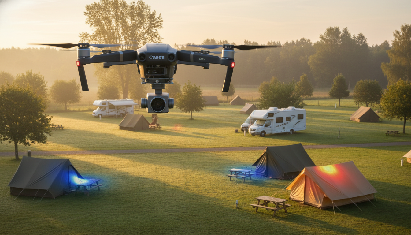
Now imagine launching a ten-minute dawn drone flight that paints those hot spots in blazing color before anyone pours their first coffee. One look at the thermal map tells your crew where to roll out shade sails, pulse sprinklers, or reroute foot traffic—turning swelter into welcome-back breezes.
From flight plans that respect FAA rules to ROI tricks that pay for themselves in ice-cream sales, this guide shows how radiometric drones are redefining guest comfort at forward-thinking parks. Ready to turn invisible heat into visible gains? Let’s fly.
Key Takeaways
• Hot ground makes campers leave and costs the park money
• A small drone with a heat camera can fly for 10 minutes and find the hottest spots
• Workers can cool these spots early with water, shade, or by moving foot paths
• One beach campground got its drone money back in 8 months by selling cooler sites and drone souvenirs
• Renting a pilot costs $250–$400 each flight; buying a $9,000 drone can lower electric bills 8–12%
• The heat map becomes an easy to-do list: quick fixes, one-day jobs, and big future projects
• Telling guests when you fly, blurring faces, and staying 30 meters away keeps everyone safe and happy
• Heat maps can also be fun: text tips for cool places and $10 drone classes add new income
• Simple checklist: choose spots, plan flight, take pictures, make map, fix hot areas, check savings.
The Invisible Heat Tax on Campsite Revenue
Two identical RV pads can sit forty feet apart yet live in entirely different climates. When one pad bakes at 104 °F and the other rests at 83 °F, the hotter site often sits empty all weekend, costing you nightly fees and the retail sales that follow occupied rigs. Multiply that vacancy by an entire row of south-facing sites and the invisible heat tax starts eating into margins you never knew were leaking.
Surface heat drives more than occupancy; it strains infrastructure. Excessive ground temperatures push AC compressors into overtime, force extra ice deliveries, and scorch turf so badly that you re-sod or reseed months ahead of schedule. Each of those unseen costs is a line item waiting to be erased once heat islands show up on a color-ramped map.
Case Study: Pre-Dawn Flights on the Gulf
The Navarre case study turns thermal theory into dollars at dawn. Flying a compact quadcopter below 50 m with a 640 × 512 radiometric sensor, staff capture a full-park orthomosaic in under twenty minutes, then hit 118 °F volleyball courts with water before sunrise and steer families toward cooler boardwalks during peak hours. The same map anchors a weekly Drone Demo night where guests compare their handheld IR readings to the aerial scan, creating an educational amenity that keeps families on-site—and spending.
Those demos do more than entertain; they offset costs. Souvenir STEM kits, branded USB drives loaded with the day’s map, and premium campsite upgrades marketed as “Guaranteed Cooler Pads” helped Navarre recoup the drone purchase in just eight months. When guests can literally see the park fighting heat on their behalf, positive reviews spike and repeat bookings follow.
The Bottom-Line Math Behind Heat
Budget planning for thermal mapping starts small and scales smart. Most operators pilot the concept by hiring a licensed Part 107 contractor for $250–$400 per 50-acre flight, avoiding up-front capital while still collecting actionable data. When the ROI math confirms value, a mid-tier radiometric drone—about $9,000—often pays for itself faster than you burn through three staff hours walking 200 sites with handheld guns.
Hard savings appear on utility and maintenance ledgers. Camps that log post-drone interventions routinely see 8–12 percent drops in electricity during peak season, fewer emergency ice deliveries, and a 30 percent extension on turf-replacement cycles. Add soft revenue—STEM workshops, thermal-map merch, cooler-pad premiums—and the payback period tightens even further.
Demystifying Drone Thermal Mapping for Operators
Gear selection need not be intimidating. Choose an FAA Part 107-compliant quadcopter, keep the altitude below 120 m, and activate built-in geo-fencing so the craft never wanders above guest congregations. Pair it with a radiometric camera such as the FLIR Duo Pro R; absolute temperature data beats colorized guesses when you’re deciding whether to mist a playground or schedule a full resurface.
Timing is your silent partner. Pre-sunrise sorties spotlight residual heat that lingers after darkness, revealing pads that never truly cool. Midday flights—11:30 to 13:30—capture peak contrast between asphalt loops and shaded lawns. Many parks run both windows quarterly to understand diurnal swings without inflating flight hours.
Efficient waypoint design trims noise and battery swaps. Outline polygons for pine groves, lakeside lawns, and high-density RV rows, then let software auto-generate only the waypoints that matter. The result: 30–40 percent shorter flights, fewer guest complaints about buzzing overhead, and more time left on each battery for a rapid second pass if needed.
Behind the sticks, divide labor for speed and accountability. A Flight Lead handles NOTAM checks, prop inspections, and airspace calls, while a Data Lead manages SD cards, cloud uploads, and map processing. Cross-train at least two team members per role so vacations or turnover never ground the program.
From Orthomosaics to Actionable Punch Lists
Raw pixels don’t cool campsites—actions do. Load 16-bit TIFFs into QGIS, set emissivity values for grass, sand, gravel, and asphalt, then merge frames into a single orthomosaic before breakfast. Standardize the color ramp so red always signals the same temperature band; your crew will read the map at a glance.
Translate colors into a triage list. Quick fixes under thirty minutes include pulse-cooling tent pads at dawn, deploying portable shade sails over picnic tables, or simply rerouting the morning dog-walk trail. One-day jobs swap dark mulch for light gravel or add reflective tape to metal railings, while larger capital projects—deciduous trees west of RV rows, permeable pavers replacing blacktop, solar-panel pergolas—slot neatly into next year’s CapEx plan. Document each intervention in the same GIS layer so wins accumulate instead of evaporate.
Your Field-Ready Quick-Start Checklist
A well-sequenced checklist turns inspiration into implementation. By walking your crew through a repeatable framework, you ensure that every thermal drone survey translates directly into lower temperatures and higher guest satisfaction. Think of it as the bridge between colorful maps and real-world comfort—the operational connective tissue that holds the entire heat-mitigation program together.
Beyond clarity, a written roadmap accelerates adoption. New hires grasp expectations on day one, seasonal staff need less hand-holding, and management gains a clear timeline for measuring ROI. In short, this campground heat map workflow keeps results consistent, auditable, and scalable as you expand to additional properties or integrate new “thermal drone survey” technology.
1. Pinpoint target surfaces—tent pads, asphalt loops, sun-baked beach sand.
2. Decide whether to hire a contractor or invest in hardware; run ROI math.
3. Secure a Part 107 pilot or enroll staff in training.
4. Appoint Flight and Data Leads; draft the pre-flight checklist.
5. Schedule the inaugural pre-sunrise flight, placing waterproof temperature loggers the night before for ground-truthing.
6. Process imagery in QGIS, validate readings, export the heat map.
7. Classify hot spots into quick, one-day, and capital tasks; act immediately on the first two.
8. Upload the finished map to your guest portal, launch optional text alerts, and review savings each quarter.
Turning Data into Guest Delight and Marketing Lift
Transparency converts surveillance fears into appreciation. Post a concise drone-use policy at check-in, list flight windows, and note that sensors face straight down to avoid capturing faces or license plates. Auto-blur occupied pads before sharing public maps and you’ll quell privacy concerns before they ignite.
Heat maps double as concierge tools. Push opt-in text alerts—“Today’s coolest hammock spots” or “Shaded pickleball court ready at 3 p.m.”—and guests perceive the park as attentive and high-tech. Offer a $10 workshop where families fly mini drones and align their readings with the master map, and you’ve added a paid activity that also cements brand loyalty.
A single dawn sortie can cool your pads, delight your guests, and fatten your margins—but the real upside appears when that thermal intel feeds an ecosystem of smart marketing and automation. Imagine heat-map data auto-triggering sprinkler cycles, texting families the day’s “Cool-Pad” upgrades, and flowing straight into ads that spotlight your breezy sites before competitors even feel the sun. Insider Perks already links AI, advertising, and on-site tech for parks just like yours; plug your new infrared insights into our platform and the temperature drop turns into measurable revenue lift. Ready to convert hidden heat into headline-worthy guest experiences? Let’s get your park—and your profits—running cooler with Insider Perks today.
Frequently Asked Questions
Q: How much does it realistically cost to start a basic in-house thermal drone program for a 100-acre park?
A: Most operators spend about $9,000–$11,000 for a mid-tier radiometric drone, two extra batteries, insurance, and a rugged tablet; add roughly $250 for a weekend Part 107 prep course and $175 for the FAA exam, putting turnkey launch costs near $11,500—often recoverable within a single peak season through electric savings, reduced turf replacement, and premium “cool pad” upsells.
Q: Can I just hire a contractor instead of buying a drone to see if this works for my property?
A: Yes—FAA-licensed contractors charge $250–$400 per 50-acre sortie, deliver processed orthomosaics within 24 hours, and typically include signed privacy and liability waivers; many parks run two to three contracted flights to prove ROI before committing to their own aircraft.
Q: Do I need a Part 107 license if my staff only fly over our private land?
A: Yes; the FAA classifies any drone use tied to a business—even over your own acreage—as commercial activity, so whoever flies must hold a current Part 107 Remote Pilot Certificate and follow all operational rules, including daylight waivers for dawn sorties when applicable.
Q: How often should I capture thermal maps to keep the data actionable without creating busywork?
A: Quarterly flights—one pre-sunrise and one midday—give most parks a reliable picture of seasonal extremes, but you can drop to twice per year in temperate regions or ramp to monthly during heat-wave summers or after major landscaping changes to verify their impact.
Q: Will guests complain about privacy or noise from the drone?
A: Parks that post flight schedules at check-in, limit operations to early morning, and show that sensors point straight down report minimal pushback; in fact, sharing blurred, face-free heat maps and offering a short “drone demo” activity often flips potential complaints into a tech-savvy amenity that boosts reviews.
Q: How accurate are drone thermal readings compared to handheld IR guns on the ground?
A: A radiometric sensor like the FLIR Duo Pro R delivers ±2 °C accuracy when you calibrate emissivity for each surface type and ground-truth with two or three $30 temperature loggers, yielding data close enough to guide irrigation, shade placement, and resurfacing decisions.
Q: What software do I need to stitch images and create a color-ramped heat map?
A: A workflow of free QGIS for mosaicking plus the vendor’s included mission-planning app is sufficient; if you prefer push-button cloud processing, services like DroneDeploy or Pix4Dreact cost $49–$99 per month and automatically export georeferenced TIFFs ready for your maintenance crew.
Q: Are there insurance implications I should know about before flying over occupied sites?
A: Many commercial property policies exclude aviation, so most parks add a $1 million unmanned aircraft rider—about $500–$700 annually—or buy per-flight coverage from on-demand providers like SkyWatch when guests are present, ensuring liability gaps are closed.
Q: How do I keep flights wildlife-friendly, especially near nesting areas or protected habitats?
A: Schedule missions outside sensitive seasons, maintain a 100-foot lateral buffer from known nests, and cap your altitude at or below the tree canopy to minimize disturbance; documenting these measures in a wildlife impact memo can satisfy state environmental agencies if questions arise.
Q: What is the typical battery life and coverage per flight?
A: A modern quadcopter with a radiometric payload stays aloft 26–32 minutes, enough to map about 40–50 acres at 60 m altitude; carrying three batteries lets you cover 120–150 acres—including landings and swaps—within an hour while guests are still brewing coffee.
Q: How quickly can the maintenance team act on the data after a flight?
A: With a practiced workflow, you can land the drone, pull the SD card, run an automated stitch, and export a color-coded heat map to tablets or printouts in under 45 minutes, allowing the crew to start misting, shading, or rerouting footpaths before the sun fully ramps up.
Q: Do thermal maps help with long-term capital planning or just day-to-day fixes?
A: They do both—immediate actions include watering hot pads and deploying shade sails, while year-over-year comparisons reveal chronic hot zones that justify bigger investments like solar pergolas, reflective paving, or tree plantings, giving you data-backed support for CapEx proposals.
Q: What payback period are parks actually seeing once they purchase their own drone?
A: Operators who integrate thermal mapping into daily maintenance and add even one ancillary revenue stream—STEM workshops, “cool pad” upsells, or branded thermal map merch—consistently report breakeven in 8–14 months, with subsequent years delivering pure savings and guest-satisfaction dividends.