
Imagine the first swirl of smoke curling up from the ridge while 200 guests toast marshmallows below—every second you hesitate costs cabins, rigs and reputations. What if an always-awake camera spotted that wisp four minutes earlier and pinged your phone with a color-coded evacuation map before anyone even smelled danger?
AI is now that sleepless fire marshal. Computer-vision sensors, predictive-analytics dashboards and drone patrols can warn you when and where a blaze might spark, steer staff in real time and shave precious minutes off 911 response. The result: safer guests, lower insurance premiums and a season that doesn’t end in ashes.
Ready to turn machine learning into your newest ranger? Read on to discover the five must-do steps—plus grant tips and ROI math—that transform hi-tech alerts into boots-on-the-ground action before the next red-flag wind picks up.
Key Takeaways
– AI cameras and sensors watch for smoke all day and night, warning you in seconds
– Computer models predict tomorrow’s fire danger, letting you plan ahead
– Drones fly over hard-to-reach spots, spotting heat and guiding crews
– Clear step-by-step plans turn alerts into quick, calm evacuations
– Trimming trees, adding gravel paths, and removing brush help stop flames
– Staff must learn the gear, check batteries, and practice fire drills often
– Grants and lower insurance bills can cover much of the tech cost
– A simple 60-day checklist shows how to start fast and stay safer.
Why Wildfire Risk Is Rising For Campgrounds
Wildfire seasons are stretching longer, burning hotter and creeping closer to recreation corridors. Five of the ten largest U.S. fires on record have ignited since 2020, and many started within striking distance of trails, tent loops and propane fills. Outdoor-hospitality properties face unique exposure because fabric shelters, scattered supervision and guest campfires can turn an ember into an inferno faster than urban structures.
Regulators and insurers have noticed. Colorado, for example, earmarked $7.5 million in 2025 specifically for AI wildfire technology, suggesting future building codes and underwriting standards will expect digital defenses state funding news. Forward-thinking operators who adopt these tools early not only reduce danger, they future-proof their permits and policies.
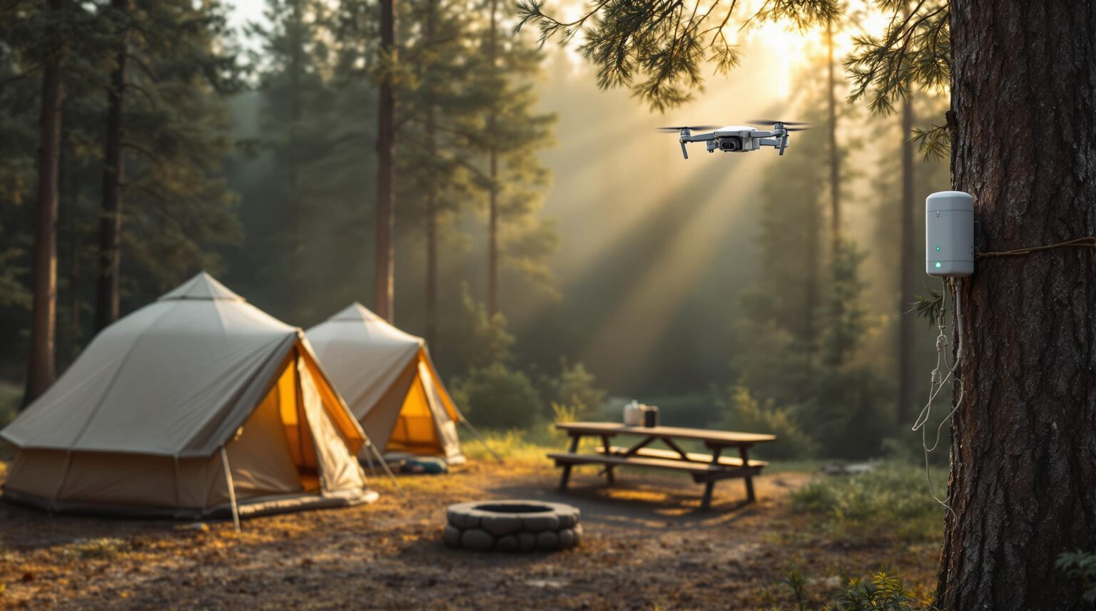
Always-Awake Detection: Camera And Sensor Meshes
Networks of HD cameras and environmental sensors now scan skies and tree lines 24/7, using machine-learning models to separate a harmless grill plume from a ridge-line smoke column. The moment algorithms flag a threat, they fire off SMS, app and radio alerts to designated staff and, if configured, to local fire dispatch. Because many devices run on edge hardware, insights arrive in seconds even when bandwidth is thin Forbes AI fire article.
Cost barriers are dropping too. Edge units can mount on existing light poles or lookout towers, avoiding pricey satellite uplinks. A single panoramic camera covering ten miles can cost less than one night of mid-season vacancy, making early detection the cheapest insurance you’ll ever buy.
Forecast Tomorrow’s Ignition With Predictive Analytics
Detection is half the battle; prediction puts you one step ahead. By fusing decades of fire history, live weather feeds and satellite fuel maps, AI platforms generate hourly ignition probabilities for every acre of your property Forbes AI fire article. Operators can time controlled burns, restrict generator use or reschedule high-risk events when models signal danger spikes.
These risk layers double as site-design blueprints. If a forecast repeatedly paints your hillside cottages crimson, that’s your cue to widen gravel paths into fire breaks or swap resinous pines for maple. Over time, fewer red-flag shutdowns translate to steadier bookings and happier guests who appreciate your visible stewardship of the land.
Drones Add Eyes Where Trucks Can’t Drive
Autonomous aerial surveillance fills the blind spots between cameras and human patrols. Drones equipped with thermal sensors fly preset grids at dawn, dusk and during lightning storms, beaming HD data back to a tablet in the maintenance shop Forbes AI fire article. One 200-acre glamping resort cut ground patrol labor 60 percent and still tripled its coverage, catching a smoldering snag before sunrise—no guest ever knew.
Because drones pierce smoke, they remain useful even after a fire starts. Real-time hotspot maps help crews decide whether to close a trail, reroute an evacuation convoy or simply assure nervous campers that the glow on the ridge is safely miles away. The extra intel often lets you keep perimeter loops open, preserving revenue while crews work the hot zone.
Smart Response: From Dashboard Ping To Guest Evacuation
An alert is meaningless if the next step is confusion. Convert that first AI ping into a written decision tree: who verifies the feed, who calls 911, who grabs the loudhailer and who shuttles mobility-limited guests. Post laminated copies at the front office, bathhouses and maintenance shed so staff can act even if Wi-Fi dies.
Quarterly tabletop and full-scale drills cement muscle memory. During drills, stage go-bags packed with radios, cones and spare batteries at key trailheads; the simple act of opening those bags during practice will shave minutes when it’s real. Assign one incident-command post—often the front desk—to coordinate all radio traffic to keep instructions clear. Guests see order, not panic, and insurers see a documented plan.
Design Your Property To Starve Fire
AI risk maps reveal where embers are most likely to land; use that intel to sculpt defensible space. Keep at least 30 feet of lean, green zone around structures, prune limbs six feet up and haul away debris. Swap resin-rich evergreens near cabins for aspen or maple, and place firewood bundles and propane cages outside the heat-radiant zones highlighted by your analytics dashboard.
Gravel parking spurs and widened walking paths double as fire breaks, slowing surface flames without sacrificing aesthetics. Schedule monthly chipping days and let guests watch; visible stewardship fosters buy-in when certain loops close for fuel reduction. Over time, cleaner understory means fewer sparks to begin with and quicker containment if one escapes.
Staff And Hardware: Train, Maintain, Repeat
Tech fails when no one owns it, so nominate a Wildfire Technology Lead to check sensors, swap drone batteries and log firmware updates. Cross-training is your redundancy chain; seasonal desk clerks should know how to silence a false alarm or launch a reconnaissance flight. A single line of accountability prevents the silent failure of uncharged batteries that can leave an entire ridge unwatched.
Stock spare lenses, SD cards and battery packs on-site; shipping delays in July can leave blind spots. Document every maintenance action in a shared spreadsheet—many insurance carriers reward such proof with premium credits. Add wildfire modules to onboarding so new hires interpret dashboard colors as fluently as they fold a map.
Funding And Insurance: Turn Safety Into ROI
Edge devices and phased deployments make costs digestible. Start with one sensor cluster, track near-miss detections and show those metrics to your broker; operators report double-digit premium reductions after presenting data-backed mitigation steps. Those smaller, bite-size investments also sidestep cash-flow shocks that often derail safety projects.
Public money is out there. Colorado’s AI wildfire fund signals a wave of grant programs other states may replicate state funding news. Pair grants with documented fuel-reduction hours and you may secure 50–75 percent reimbursement. Market your tech-forward safety posture online—higher guest confidence often supports premium site fees that recoup investment within a season.
Your 60-Day Quick-Start Checklist
Sixty days is often the gap between recognizing a wildfire threat and watching the next red-flag warning light up your weather app. Give your team a finite horizon and the goal feels achievable instead of abstract. A clearly defined, two-month sprint also aligns with most off-season maintenance calendars, letting you roll improvements into the quieter weeks without upsetting peak-season revenue.
The checklist below distills the entire implementation journey into bite-size weekly tasks. Treat each line item as a mini-milestone you can check off during staff huddles, and celebrate quick wins to keep momentum high. By the end of the eighth week you will have hardware installed, staff trained and drills documented—evidence you can show insurers, regulators and, most importantly, your guests.
Week 1-2: Audit current defensible space, signage and communication channels. Tag camera-ready poles and note poor cell-signal pockets where edge devices shine.
Week 3-4: Demo a sensor package or drone service, then draft a one-page alert decision tree with roles and backup contacts. Confirm 24/7 contact with local fire dispatch.
Week 5-6: Train core staff on the dashboard, integrate a mass-text plug-in to your reservation software and print bilingual safety cards for welcome packets.
Week 7-8: Run a tabletop drill, adjust gaps, log results for insurance files and schedule your first vegetation-management day with guest notice.
Finish the eighth week by archiving photos, sensor logs and drill scores in a shared drive so future seasons start from a higher baseline. Then schedule a quick debrief with your local fire agency to review lessons learned and fine-tune next year’s calendar. Consistent iteration turns this 60-day jump-start into a standing culture of readiness that pays safety and marketing dividends for years to come.
The next red-flag warning is already on the calendar—what’s missing is the data engine that turns it into just another line item on your operations checklist. If you’re ready to bolt AI wildfire monitoring onto the same systems that keep your marketing emails, reservation funnels and guest messaging running, Insider Perks can make it happen. Our team fuses automation, advertising know-how and property-specific analytics into one streamlined command center, so you protect revenue while you protect guests. Let’s put always-awake technology on watch before the first spark flies—schedule a quick strategy call with Insider Perks today and see how safety, efficiency and smart storytelling can ignite your next record season.
Frequently Asked Questions
Q: How accurate are AI smoke-detection cameras compared with a human lookout?
A: Field studies by state forestry agencies show modern computer-vision units spot wisps of wildfire smoke up to four miles away about 90 seconds faster than trained observers and with less than a 3 percent false-positive rate, meaning you gain valuable lead time without a flood of nuisance alerts.
Q: What kind of internet connection does my campground need for these systems to work?
A: Most edge-based cameras and sensors process images locally and send only lightweight alert packets, so a basic DSL, Starlink or even a 4G hotspot is usually sufficient; if service drops entirely the devices continue scanning and will push notifications the moment bandwidth returns.
Q: We already have security cameras—can they be repurposed for wildfire detection?
A: Yes, as long as the cameras offer at least 1080p resolution and a clear view of the horizon you can license AI software that overlays on your existing NVR, though you may still add one or two 360-degree pan-tilt units to eliminate blind spots the security network never needed to cover.
Q: What is the typical upfront cost for a small RV park and how quickly do operators recoup it?
A: A starter kit with one panoramic camera, two weather sensors and a year of cloud analytics generally runs $4,000–$7,000, which many parks offset within 12–18 months through 8–15 percent insurance-premium reductions and the ability to remain open on marginal red-flag days when less prepared competitors close.
Q: Will guests complain about drones buzzing overhead or cameras invading privacy?
A: Most parks schedule drone flights at dawn and dusk above tree height and point fixed cameras toward ridgelines, not sites or bathrooms, then explain the safety purpose in welcome materials, so feedback trends positive and many guests actually cite the technology as a reason they felt safer booking.
Q: How do we keep false alarms from panicking visitors in the middle of the night?
A: The alert workflow sends the first ping solely to staff phones and dashboards; a designated employee verifies the image feed before any siren or guest notification triggers, ensuring only confirmed events escalate to public messaging.
Q: What training do seasonal employees need to interpret the dashboard?
A: A one-hour hands-on session covering color codes, the confirmation checklist and the evacuation decision tree is usually enough, and most vendors include video refreshers your team can replay each time new staff arrive.
Q: Are there grants or public funds available to help pay for the equipment?
A: Several states, led by Colorado’s $7.5 million program, reimburse 50–75 percent of eligible hardware and software costs, and many rural counties channel FEMA hazard-mitigation dollars to private recreation businesses that document a community benefit, so submitting a short proposal with your defensible-space plan can unlock substantial aid.
Q: Do insurance carriers really offer discounts for installing AI wildfire tech?
A: Yes; underwriters treat verified early-detection and predictive-analytics systems like sprinkler retrofits, and operators who share sensor maintenance logs and drill records commonly see double-digit percentage drops at renewal.
Q: Who owns the data that the cameras and sensors collect?
A: Contract terms vary, but most platforms grant the park full ownership of raw footage and environmental data while receiving a license to anonymize and aggregate it for model improvement, so you retain control over any clips that identify guests.
Q: What happens if the system fails during a power outage?
A: Edge devices typically ship with solar panels or battery backups good for 24–72 hours, and they cache alerts locally so the moment power or connectivity returns you receive a timestamped summary to evaluate any gaps.
Q: Are there regulatory hurdles for flying autonomous drones over my property?
A: Recreational parks fall under Part 107 of the FAA rules, which require a certified remote pilot, daylight operations or a waiver for night flights, and most vendors bundle compliance training and airspace-approval templates to streamline the paperwork.
Q: How do I start small without committing to a full network?
A: Many vendors offer a 60-day pilot that includes one portable sensor stack and software access; by placing it on your most exposed ridge and tracking near-miss detections you can quantify value before scaling to a permanent mesh.
Q: Can multiple parks share the same monitoring center to cut costs?
A: Absolutely; groups with two or more properties often pool feeds into a single incident-command dashboard staffed by a rotating manager, lowering per-site licensing fees while ensuring someone is always watching overnight.